
Explore 1876 Richmond with newly digitized maps
November 29, 2023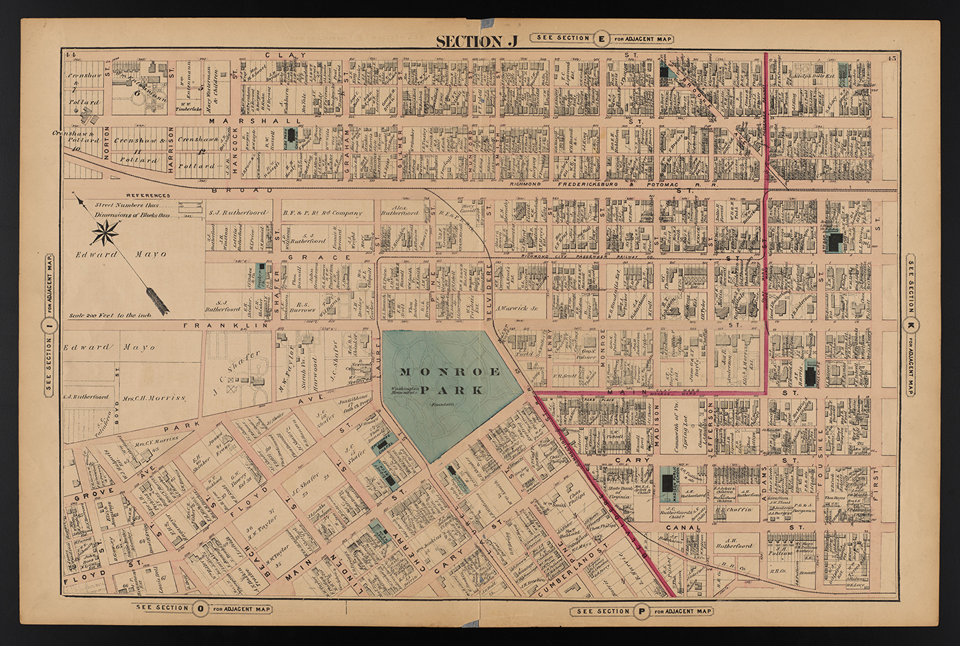
There is something magical and enchanting about exploring old maps of the city in which you live. You see the historic skeleton of avenues and neighborhoods. And, you can imagine the lives of people who walked these same streets before you. At least that’s how map-reading can feel for people who have a feel for maps.
A new VCU Libraries digital collection introduces the Illustrated Atlas of the City of Richmond, Va. Also known as the Beers Atlas, the resource was published in 1876, some 20 years before Old City Hall or the Jefferson Hotel were built and some 20 years after the Egyptian Building opened as a medical college. The maps offer insight into the state of the city–residential and commercial locales, architecture and infrastructure– less than a dozen years after Richmond’s prime business district south of the Virginia Capitol was decimated by fire at the end of the Civil War.
Frederick W. Beers, from a family of cartographers, was a publisher of atlases and maps. The Richmond Beers atlas includes a table of contents, 21 maps, seven illustrations of businesses and eight pages of advertisers’ notices.
The original copy is available in Special Collections and Archives. Exploring the digitized version, researchers can zoom in or out to enlarge images or narrow the focus to a particular view of elements. The images, which are free of copyright restrictions, are downloadable for use in presentations and publications.
The atlas shows a variety of buildings and structures, parks and green spaces, and places of worship. Waterways are highlighted in green. Property lines are detailed and often include the names of owners of many properties.
The Beers Atlas is a companion to the 1889 Baist Atlas. These two collections provide an opportunity to interrogate systemic racism found in the historical record of property lines, omission and naming conventions, according to Irina Rogova, digital initiatives librarian. “These maps, created decades before the Virginia General Assembly passed racial segregation ordinances in 1912, offer insight into the built environment of Richmond following the Civil War as racial demographics shifted after the abolition of enslavement,” she said. “The maps provide a lot-by-lot look at neighborhoods that were transformed by redlining and urban renewal in the 20th century. Some of these neighborhoods today are undergoing development and change that can be characterized as preservation or gentrification.”
The two digital collections now live under a new Scholars Compass collection entitled City of Richmond Atlases and Maps.
< Previous Next >